Being in control through smart digital surveying
23 May 2023
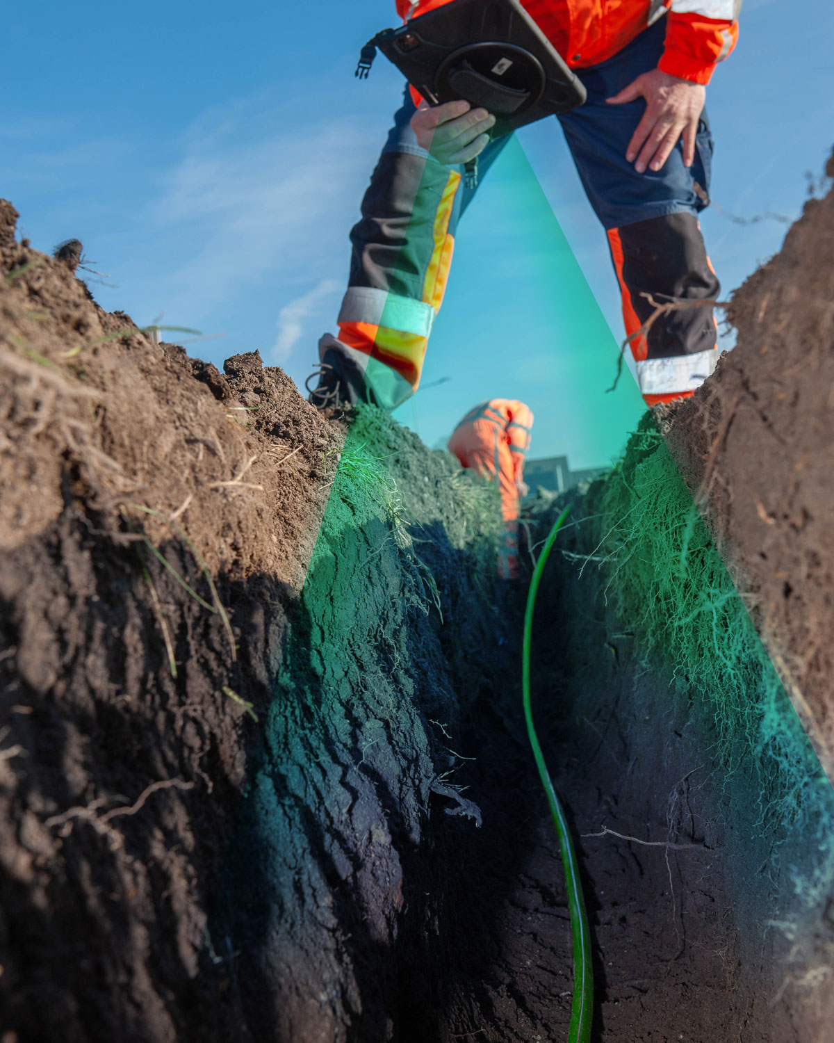
Laying fiber optic cables underground is precision work. Allinq introduces a solution that accurately records where and at what depth pipes have been laid. The excavation team simply scans the area where the cable has been laid with a mobile phone or tablet. The data is then processed in a 3D platform, in other words, a three-dimensional map. This digital surveying solution In Control offers a broad range of information.
By surveying the trench digitally, it is known exactly where the cables are and at what depth. “We speed up the surveying process and show our customers quickly and easily what we deliver,” says Hessel van der Bij, Product Owner at Allinq. “It is pleasant for all parties involved to visualize production in this way. This not only provides many advantages during construction but also in the future for the service process and the realization of later connections.”
Record in the land register
An incredible amount of cables and pipes from various suppliers lie underground. All gas, water, and electricity connections in the Netherlands are recorded in a land register. “Parties planning to dig a trench must notify the Cables and Pipelines Information Center (KLIC),” says Hessel. “By surveying cables, contractors can work safely and damage to networks can be prevented as much as possible.”
Three-dimensional world
So far, surveying cables has been done manually or by an external party. “With In Control, the excavation team can easily record the fiber optic cables themselves when the trench is open,” explains Jalbert Landwaart, Operational Product Manager at Allinq. “This approach and method has many advantages. The digital measurement of the location of the cables is done accurately so that we get a good picture of the situation underground. In addition, we have the burden of proof to governments and clients about the work performed. We can also add other relevant information, such as photos, specific features, plans, maps, and building details. This creates a very complete platform: a three-dimensional world full of data. Moreover, we can find cables and pipelines underground more easily and quickly in the event of a malfunction than on separate photos, sketches, or drawings.”


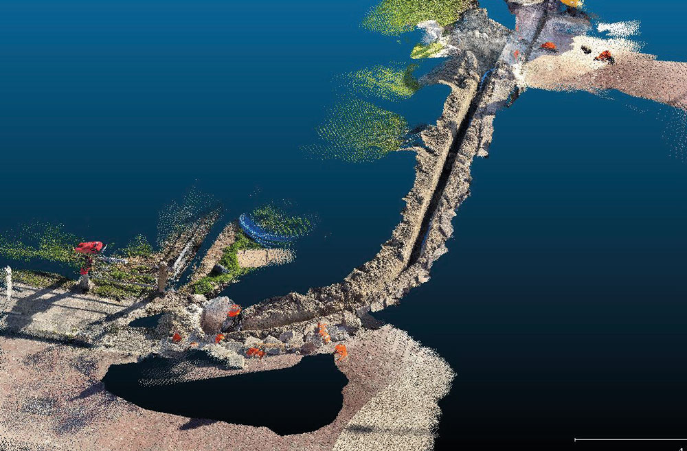
Through our app In Control, a PointCloud is created of the excavated route

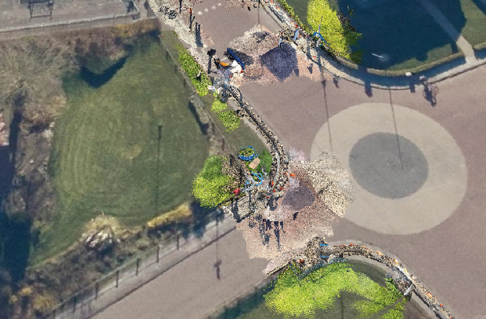
This PointCloud is processed in the aerial photo. The result is a clear dashboard of the excavated route.
Underground infrastructure
In Control works with LiDAR scanning and creates a 3D model of reality. This 3D model shows all kinds of useful data about the location of the cables, such as depth, length, and ground cover. Knowledge about the soil cover is valuable, because digging through the verge, for example, is easier than through tiles or pavers. The depth and length determination are very accurate and provide an extremely accurate picture of the underground infrastructure. In addition, In Control offers much more information. The visual recording is therefore a huge improvement and progress compared to sketching the situation or surveying with a GPS stick. With this last technique, Allinq is dependent on third parties. The surveying requires a high degree of complexity and is often performed by an external surveying service. If civil teams no longer have to coordinate the surveying with third parties and can do it themselves from now on, this will save a lot of time.
Testing internally
“In 2021, the idea arose to develop our own app and platform for smart digital surveying,” says Jalbert. “It’s amazing how far we’ve come! The technology runs as desired and we process data into accurate digital drawings. Internally, we are fully testing the app before we launch it on the market and start using it with our customers. In Control gives us more flexibility and scalability for the future.”
Easy in use
Allinq’s civil employees will incorporate digital surveying into their daily work process. “We therefore put a lot of time and energy into the user-friendliness of the app,” says Hessel. “The app is simple and easy to use,” adds Jalbert. “You scan the location of the fiber optic cables, upload the recording and it appears on the platform. This gives you more insight into what you are doing, you are independent of third parties and you will spend less time looking for the right drawings or distribution points in the future. You are therefore in control! Colleagues are even so enthusiastic that they have ideas to expand the app.” One of those ideas is to first check the result before sending the recording. Suppose you have forgotten to film part of the trench, then you can make a new recording. Other wishes include adding a separate field for comments, announcements, or extra photos. Allinq immediately takes this feedback from the field into account.
Innovation is an important core value and with our total solution for digital surveying we are at the forefront"
Hessel van der Bij
More control over the implementation
Allinq closely monitors developments. “Innovation is an important core value and with our total solution for digital surveying we are at the forefront,” says Hessel proudly. “The developed application is a springboard for further digitization of construction processes. If our civil employees perform digital surveying with the app every day, they will have a better view of the progress of production. We spend less time on administration, which means we can deliver areas to our customers faster. In short, we gain more control of the implementation.”
Valuable information
“This is only the beginning of what we are developing with In Control”, Jalbert concludes. “Our primary goal was to realize a method that makes surveying the trench faster, more accurate, and easier. The app offers a broad range of valuable information. We will be expanding and perfecting the product step by step so that we can continue to serve our customers optimally.”
Contact?
Jalbert Landwaart
Product owner
